Thursday, August 8, 2013

Trip Overview


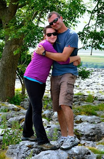
Hello everyone! Brittany from the duo here. Even a week after being home I wish I could still go back! This trip was the trip of a lifetime. 
That being said, I wanted to share a photo with you guys so you all could see exactly where we went on this amazing trip. Hope you enjoyed reading the blog!


We started in London, then went down past Poole to the coast. After that we continued to go west as we headed to Dartmoor National Park, in the southwest corner of the country. Next, we headed up to Wales and Snowdonia National Park, all around Barmouth and on the coast by the North Atlantic Ocean. After a long stay in Wales, we headed up to the most northern part of the country that we visited and stayed in Yorkshire Dales National Park. After a quick stay there, we journeyed back to London and got on our individual flights back to the states.

Hope you enjoyed this brief overview of the trip!


Tuesday, August 6, 2013

Day 11 - A Fond Farewell


Well friends, this is the saddest blog of the trip – the last one.  It’s been an epic journey, with new friends made and experiences we will never forget.  Over the past couple of weeks, we have seen some amazing landscapes and today was no different.

Ingleton Limestone Quarry
We started the day at the Ingleton Limestone Quarry.  While not necessarily as beautiful as other landscapes we’ve seen, it was pretty jaw dropping to see how massive it was.  It is currently at a depth of about 140 meters, with about 50 meters of material still left underneath the current depth.  However, the footprint on the land is so small that they do not expect to be able to go deeper as they need to keep a certain slope for safety reasons.  When the quarry is retired, it will likely be filled with water and may be used as a SCUBA training facility.
 
Our next stop was a limestone pavement.  This was more the pretty landscape we were used to seeing!  From a distance, it looked like one big rock with some bushes and a couple of trees popping up sporadically throughout, but a closer look revealed large crevices across the landscape.  Water mixing with carbon dioxide in the air creates a mild acid that reacts with the limestone and washes it away.  This causes widening of the joints, called grykes.  These grykes are important to the native habitat because of the vegetation that they allow to grow there.
Limestone Pavement


Near the limestone pavement, we came across some holes that formed in the grassy areas nearby.  These are known as shake holes and are the result of water concentrating into one spot underground.  The first few we saw were not very impressive.  However, the last one we saw was absolutely massive and very deep, which of course had BJ cringing in fear.


Gryke - No sheep in this one.
The hike to and from these last features was pretty long, but somewhat entertaining as well.  There was one area where we had to walk off the beaten path and up a hill to avoid a group of cows because apparently they are aggressive, should one walk between a cow and its calf.  Nearer to the limestone pavement, we ran into some sheep.  Chelsey had fun chasing them while the class made some pretty terrible sheep impressions.  According to a local sheep tender, there was one stuck in a hole near where we were.  BJ and Chelsey could hear it and very badly wanted to rescue it.  But the landscape was too vast to go on a search and rescue mission.


The gang hikes up a hill to avoid the scary cows!


Shake Hole
"What are these crazy two-legged creatures doing up here?"
And with that, our last academic day comes to a close.  All that’s left now is a 5 hour drive back into London where we will have our last night together.  Tomorrow we will board our flights and go our separate ways.  It’s been an amazing adventure, both academically and personally.  We have learned things, seen things, and felt things we never thought possible. 

The Dynamic Duo say goodbye.
It’s amazing how a group of perfect strangers got together and bonded.  The group as a whole became very good friends.  And for the Dynamic Duo and the rest of the “Fab 5,” a bond was created that won’t be soon forgotten.  As much as we all may be happy to get back home, a piece of our hearts will always be with each other and the friends that we made across the pond. Dr. Collins shared one of her favorite poems with us which is very appropriate.
 

Rupert Brooke. 1887–1915

149. The Soldier


IF I should die, think only this of me;


That there's some corner of a foreign field


That is forever England. There shall be


In that rich earth a richer dust concealed;


A dust whom England bore, shaped, made aware,

5

Gave, once, her flowers to love, her ways to roam,


A body of England's breathing English air,


Washed by the rivers, blest by suns of home.


And think, this heart, all evil shed away,


A pulse in the eternal mind, no less


Gives somewhere back the thoughts by England given;


Her sights and sounds; dreams happy as her day;


And laughter, learnt of friends; and gentleness,


In hearts at peace, under an English heaven.


It was a great journey and we thank each and every one of you for sharing it with us.  Hope you all enjoyed the blog as much as we enjoyed writing it!


Cheers,

The Duo


Sponsorship towards the creation of some of the materials for the Study Abroad in the UK trip provided by the Office of Undergraduate of Research.


Day 10: Duck and Hide


 This morning was a sad goodbye to the many good times and new friends found in Barmouth.
Chart of wintering birds
The group arrived in Leighton Moss this afternoon to tour the Royal Society for the Protection of Birds (RSPB) managed marsh areas. The success in preserving biodiversity is what has brought our group to Leighton Moss. Through funding battles and management struggles, the park has had great success with the return of otters, increased Marsh Harrier numbers and contribution to bringing the Bittern back to England. By taking advantage of carefully constructed nest sites these rare birds join common waterfowl, such as Coots and Swans to offer a great experience for visitors waiting in hides with binoculars, hoping to catch a glimpse of their behavior. Even out of the hides in more woody areas, Robins and Blue Tit birds are plentiful. Although some birds are seasonal, many stay year round, such as the Bearded Tit. Managing for the variety of needs, these birds have kept the eager staff busy and usually up to their knees in water year round. Trail signs indicate the locations of many bird boxes painted with an image of the bird expected to be seen there to keep visitors excited about what they may see next but we were lucky to get a guided tour with not one but two knowledgeable RSPB wardens.

View from the second hide
As it started raining outside our second hide, the guides spared the group from our first real rain in Britain by discussing with us some history and continued goals of the RSPB at this site. The RSPB was formed at a time when hat feathers were popular and birds were hunted near extinction just to meet this demand. Now, the RSPB has significant political sway and partners with organizations such as the National Trust, Wildlife Trust, and butterfly conservationists to implement landscape scale conservation efforts. Some of their work is designated as Futurescape or Nature Improvement Area for funding purposes. Nearby farmers receive funding to make their lands a part of the conservation mosaic through the Stewardship Scheme through which they weaken borders from their property even going so far as to flood some areas to generate marsh.

The 2013 growth chart
Unfortunately, climate change, funding cuts, and water quality still endanger this conservation site at Leighton Moss. Even small changes in salinity caused by tidal breach of the barrier cause fish die-offs. More severe weather patterns increase flooding and endanger ground nesting birds. The site already invests large amounts of money in maintaining the habitat and will be stretched if climate funding continues to target mitigation over adaptation.

The environmental service offered by this area is in holding floodwaters away from populated areas and filtering water as it drifts through into the limestone below the peat. Nearby farms, however, contribute to natural eutrophication, which the park fights against every year. Eutrophication, which here involves the decomposition of reeds into peat to the point that a soil layer is formed, allows for succession from reeded marsh to wooded area to occur more rapidly. The park dredges the waters, coppices the willows, and removes reed build up in a rotation around the park to allow different stages of wilderness to coexist and prevent a less biodiverse landscape from emerging.


Our informative tour guides
 
This preserve speaks volumes for the ability of issue specific clubs to influence policy and public opinion. The RSPB has over one million members in the UK, including a member of our class! Similar organizations exist around the world, such as the US Audubon Society. Thanks to our two guides we really got an inside look at what it takes to gather these species together for a great viewing experience and to bring awareness to conservation issues through public awareness building.


Sponsorship towards the creation of some of the materials for the Study Abroad in the UK trip provided by the Office of Undergraduate of Research.

Day 9 - Mount Snowdon

Greetings friends! The duo is quite tired today after a 3 hour hike to the top of Mount Snowdon. The peak is at 1,084 meters – about 3,600 feet. It’s the highest mountain in England and Wales so making it up was quite an accomplishment!


Tired Duo - One more so than the other.
Climbing and descending the mountain was such an adventure that there wasn’t quite as much to talk about along the way. However, at one point we discussed the glacial features that made up the landscape. These included moraines, cirques, and rounded rock tops with striations. Moraines are the result of moving glaciers pushing rock as they move, then melting leaving a mound of rock in place. Cirques are the result of ice and snow accumulating in a bowl-shaped depression. The rounded rock top with striations are evidence of glacial movement over the landscape. The striations mimic the past movement of the glaciers.


Some parts of the hike up had nice prepared trails...
Other parts, not so much.


As we continued our hike, we saw more evidence of these features as well as some other interesting things. One of the most interesting things along the higher portion of the path was BJ’s extreme phobia of heights. Most of the path was along a slope which didn’t bother him. However, during the parts with steep cliffs, he hugged the opposite side of the trail like it was his long lost brother. Another very interesting feature was a wood pillar with coins stuck in it. We figured it was like a wishing well where you would make a wish and shove a coin into it.


Make a wish!
Brittany's impression of BJ on the edge of a cliff.


The top of the mountain had a visitor center where we took a much needed lunch break and discussed how we would go about getting back to ground level. We decided on a path and took the long trek down. Overall the hike had amazing views and we all felt like we accomplished something today. Now off to bed to rest up for tomorrow.


The long trail home.

See you next time.
-The DD

Sponsorship towards the creation of some of the materials for the Study Abroad in the UK trip provided by the Office of Undergraduate of Research.


Day 8: Park and Ride


Today we continue our stay in Wales. We started off our day with a drive to Snowdonia National Park for a presentation of the area. On the way there we got a glimpse of Harlech Castle, the first one we've seen on our two week stay in the UK. The castle was originally built just off of the waterway, but since the area was drained to establish farms, the water has moved a considerable distance away. The structure of this castle is English in design; Welsh castles are typically smaller. The castle was meant to depict dominance and is still quite ominous.

Continuing our tour of cultural preservation sites, we arrived next at the visitors center of Snowdonia National Park. Here, the Principal Policy Officer, Ifer Gwyn, provided an informative presentation. The park was designated in 1951 and covers an area of 823 square miles. Despite the park's right to approve development in park boundaries, there is a population of about 25,000 people in the park, 65% of which speak Welsh, and there are nearly a thousand preserved buildings. Farming, forestry, and tourism are key to the area's economy and culture, which the park service is dedicated to protecting. The park service even distributes grants to local communities to increase their buy-in to the park's mission and enjoyment of its natural features.
Ifer Gwyn

Unlike national parks in the United States, Snowdonia is not owned by the government. Owners of the land range from farmers to the Forestry Commission. Currently the Harlech Castle is the only World Heritage Site in the park, but the Snowdonia National Park Authority is working with UNESCO to make the surrounding slate mines World Heritage Sites as well, which would better protect them, since they were originally left out of the park borders.

Ffestiniog Railway
After the visitors center we boarded a train on the Ffestiniog Railway. We departed from the harbor side in Porthmadog, arriving in Blaenau Ffestiniog. The train traveled 13.5 miles in about an hour and twenty minutes. This is a narrow gauge railway primarily staffed by volunteers. Our particular train featured a double boiler engine to scale the mountainside. The views were gorgeous ranging from streams and woodland to vast slate quarries.

Slate mine
With a quick lunch behind us, we set out to explore a Welsh slate mine. We learned the slate is metamorphic and how it formed 450 million years ago in a sea bed south of the equator. If it took the same transport we took to get there, it certainly would have been a long trip :-) There are several slate mines here, formed in different episodes. The set of mines here were mined starting in the 1820s. Life expectancy was only 40 years for miners, and family members typically worked a deposit together. After committing to mine a section of the site, miners would open slates in town to get them started- this is the equivalent of a tab that you can charge and then have the costs handled later. Although this didn't make their lives much easier, it was an interesting parallel for us.

Standing at the mouth of the mine we could feel the cool air rushing out. We were able to see the landscape for miles around. It was welcomed after the hike. Although the journey wasn't as easy as yesterday's, the views were well worth it. It featured an adit level for drainage, as seen in the tin mine. Also, the slate was partially processed just outside the mine, but in a variation from the tin process, had a tunnel carved to send the slate through as quickly as possible to the trains below. Supposedly this is an easy hike compared to tomorrow- good that we have a bit of a preview of what is in store for us.

Sponsorship towards the creation of some of the materials for the Study Abroad in the UK trip provided by the Office of Undergraduate of Research.

Day 7 - Estuary Day


“Bora Da!” That’s “Good day!” in Welsh. Today we continued our time here in Wales, where the two main languages are Welsh and English. Welsh is a Brythonic Celtic language that is in a different classification than the Goidelic Celtic languages, such as Irish and Scottish Gaelic.


Representing the Bulls in the Irish Sea!
Today was a very interesting day. We all started off being very excited for our hike. We soon found out it was a 10 mile walk through the woods. As we all piled into our very tight, very hot, no air-conditioned van (since the coach driver’s belt needed fixing), we drove off to the coast of Barmouth and into a town called Dolgellau to start our journey along the estuary.

Cordgrass


As we walked along, we stopped frequently to talk about things we saw. We observed ivy, oak, maple, sycamore, rosebushes, holly, and Japanese knotweed. Some of us knew of these already. For the others, Dr. Smith pointed them out.

Ducks go for a swim.


We also worked on some ideas of the management of the area and how Snowdonia National Park officials had to work to keep the walkway safe while also keeping its natural feel. The walkway used to be an old railway. However, it now looks completely different and doesn’t even have the old railway ties. The only thing that is still there is the old railway hut that a lot of little kids play in.
Next, we looked at a saltmarsh and saw cordgrass and the soil in which it grows. This includes soil full of silt and clay one meter below the water table. This area was one of the first places we really got to see some wildlife including ducks, swans, herons, and some fish. 

Some other interesting things we saw throughout the walk included a flyover from some Royal Army training jets, the mine from which the gold that was used to make the queen’s wedding band was retrieved, and a house that Charles Darwin called home for a short time.


Darwin House


After heading back to town for a late lunch / early dinner, we travelled back to the estuary, this time from the panoramic view. This gave us a bird’s eye view of where we had walked this morning from across the river.  From here, we could see the whole area comprised of Snowdonia National Park and a little town next door.
Panoramic View of the Panoramic View

We started the discussion on policy with a question—do rocks have rights?  The purpose of the question was to get us thinking about who is more important—humans or nature. Then we were asked to think about how much value the natural landscape has. Also, should endangered species have more value than common species? Perhaps those species which contribute most to the ecosystem and to human society should have the most value.

Justin: "Hmmm...Do rocks have rights?"
Kyra: "Cheeeeeeese!"
These are questions that come up in the planning field on a daily basis. For example, developers are constantly trying to get permission to install a marina in the water right next to Snowdonia. If it were proposed inside of the national park, the application would be shot down immediately because there are a lot of land use restrictions inside the park. But it is still a contentious issue right outside the park for a few reasons. For one, environmental groups are concerned about the effect on the fish and other wildlife in the area. One resident voiced her fear that her sheep business would be harmed in the process. But the biggest issue may have been that a marina would ruin the pristine character of the area. Supporters of the marina think that it would boost economic development for the nearby city and would also add to the tax base for that city.

It is a perfect example of the constant struggle between environmental protection and development. There are benefits to both, but there needs to be a balance.

Thanks for reading the Dynamic Duo’s wicked amazing blog. Now we are off to go swim in the Irish Sea!

- B&B


Sponsorship towards the creation of some of the materials for the Study Abroad in the UK trip provided by the Office of Undergraduate of Research.

Wednesday, July 24, 2013

Day 6: Elan Valley


Today Dr. Middlekauff, the professor from Plymouth, had to go to the hospital for emergency eye surgery. Our thoughts are with him. This caused a slight change to the schedule. Our bus driver was considerate enough to drop us off at the Elan Dam with one of our professors and our CIS coordinator. The driver then took Dr. Middlekauff and Dr. Collins to the hospital.

We began the day at the dam with a student presentation, which the presenters generously agreed to move forward a day. Chelsea Welden and John Correa spoke about the history of the environmental movement in the UK. They traced the development of environmental legislation beginning in 1273 to the present. Early legislation focused on coal use, which will be further discussed in a student presentation on air pollution. Other legislation is grouped into categories, such as energy, atmosphere, agriculture, water and wetlands, and wildlife. Although there have been several pieces of particularly successful legislation, such as the Forestry Act, UK policy is generally more species specific and reactive than in the US. Despite a similar transcendental movement in the UK and the US in the 1800's, disasters, such as the 1952 London smog, and EU directives are strong drivers of policy, whereas non-governmental agencies are less influential. This discussion provided background for touring the only non-profit owned dam in the UK.

After the presentation, we were lucky enough to have the ranger, Max, drive us to the dam. It took two trips, but once the group was reunited, Max was kind enough to take several group photos for us.

Entering the dam was a bit intimidating. Once we walked through the initial gated entrance and down the stairs, we were greeted by another locked gate. Once through, we walked down a thin, damp, barely lit tunnel. At the top of the dam, and after a few more photos, we jumped into the lesson.

The dam was built for the city of Birmingham and was put into use in 1903. It has a 15 day reserve and produces 810 kilowatts of power. It is considered a direct water supply, meaning the water does not get treated before use. This is due to the control of land surrounding the watershed which lacks industry and other polluting sources. Whenever there is a water shortage, the need for a super dam is discussed; however, the geology and laws are quite restrictive for such a massive project.

Initial water infrastructure in Britain was started by the Romans but was unable to keep pace with industrialization, as evident in cholera outbreaks between 1830 and 1870. Water resources have since been located outside of cities, as of 1880, and privatized under Margaret Thatcher. Now, the Welsh sell some of their water supply to England. One contentious fact is that London loses 30% of their water due to broken pipes.

Another welcome schedule change was the added option of hiking back from the dam or going on a nature trail. When preparing for a study abroad, advisers emphasize adaptability; today was a prime example of why.
Upon our return to the Elan Valley tourist center, we awaited the arrival of our bus over a snack. Our new hotel has a fantastic beach view. We are excited to call this home base for the next four days.


Sponsorship towards the creation of some of the materials for the Study Abroad in the UK trip provided by the Office of Undergraduate of Research.

Sunday, July 21, 2013

Day 5: Dartmoor National Park

You alright? That means “how are you doing?” over here in the UK.
Welcome back to the blog. Today we had another long day in the van and took a couple of stops in Dartmoor National Park after starting very early in the morning.

The Duo strikes again!
Don't work too hard there, Charlie!
Our journey began at 6:30 this morning and we drove an hour and a half to our first site. Immediately everyone could tell when we arrived at Dartmoor; the land turned in to rolling hills and wide open green fields that seemed to never end. There were animals including sheep, ponies and cows roaming free. It was quite amazing to see animals in the wild like this. Although we all really wanted to go and pet the ponies, we were advised not to. Next we hiked up one of the hills. As we walked along we stopped frequently to look at different stone patterns. We saw geometric features composed of sub-rounded boulders. These features ranged in size from 3 to 4 meters long to 10 to 12 meters long.  We saw stone nets, which are oval in form with a depression in the center.  These form along a steeper gradient slope.  We also saw stone stripes on even steeper slopes formed in a similar way to the nets. One can observe a pattern with lines of  stones broken up by a continuous vegetation cover that runs down a slope. Finally we noticed sorted stone circles with the long axis or A axis aligned in a circular pattern on the gentlest slopes. All of these landscape features stem from periglacial processes dominated by freeze-thaw action operating on the tor above.  We discussed the joints in the bedrock which create avenues for water to migrate laterally and downwardly. Upon freezing, expansion of the ice wedges the rocks apart into smaller ones. Periglacial processes move these rocks down the hill and form all the stone patterns on the slope. All the stones were made up of Dartmoor granite. This is a rock that has three different minerals in it: quartz, mica, and feldspar. It forms from when magma slow cools resulting in the large crystals.

Our rocky classroom. The seats weren't the most comfortable, but you can't beat the view!
Also, along the way, we found and identified three types of flowers and plant species. First was the Bell Heather, a purple bulb like flower. The color went from dark to light on each individual bulb. Next was a Potentilla. It was a yellow flower that looked very similar to a buttercup and very small. Last was the Bracken, a type of fern. It was all over the hill slope and is an invasive species in many moorlands in upland Britain.  After we made it to the top we sat down to hide from the wind, which was blowing at about 20 knots (about 23 mph) and was just about blowing Brittany over!  

Bell Heather
Potentilla
Bracken Fern


The  focus of our next stop was on human impacts on the land. These are not impacts from modern development, but rather impacts from ancient cultures. Again, we looked for patterns and other unique features and found stone circles.  Unlike the circles found at the tor on our previous stop, these were more obviously placed there with a purpose. They were oriented in a way that would not have occurred naturally.  They were placed on their sides with the widest side oriented inward. 
A circle of stones - mysterious.


Shortly thereafter, we came upon another feature affected by humans which appeared to be some sort of burial site.  It had two large stones over a shallow hole, about the right size for a body. Brittany had fun climbing in! It is important to note that we say it “appeared to be”. One thing that was made very clear during this portion of the trip is that, without concrete evidence, any ideas we have of what a feature could have been used for is just that – an idea. So while we might think, from our current perspective, that it was a burial site, we are basing that on our own modern ideas and cultural norms.


How is it down there, Britt?
Other features encountered included another stone circle; this one more spread out than the previous one and only had 11 stones in total. One theory is that this was used as some sort of calendar by which to track the seasons. Not far from this was a tall pillar. All these ‘field monuments’ are of an architectural style called megalithic.
The class discusses the pillar.


The main point made during this visit was the effect that human interactions with the environment can be long-term. The peat in this area has been analyzed for pollen types to determine the vegetation that would have been present at various times. The pollen present in the layer coinciding with the time during which these features are believed to have been placed suggests that, had that human interaction not occurred, the area would currently be wooded rather than grassy as it is today.

Overall we had a great day and all learned a lot about rocks from Dr. Middlekauff and a lot about archaeological impacts from Dr. Smith. Dr. Collins had a lot of important ideas that put everything the other teachers said into perspective. 

Until next time!
-The Duo


Sponsorship towards the creation of some of the materials for the Study Abroad in the UK trip provided by the Office of Undergraduate of Research.